


The Spanish village of Villar del Cobo in Teruel harbors a striking landscape of giant sinkholes that mimic lunar craters in the Sierra de Albarracín.
Located in the Montes Universales mountain range between pine forests and the Guadalaviar River, the small municipality has a population of just 158 inhabitants. For centuries, the village served as a key transit area connecting the modern provinces of Teruel, Cuenca, and Guadalajara.
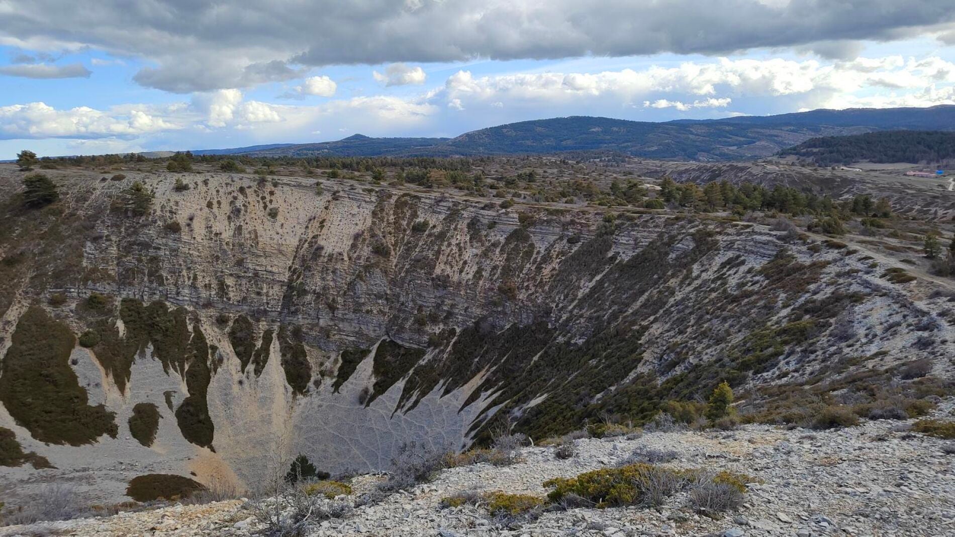
Situated just a few kilometres from the urban centre of Villar del Cobo, the geological formations resemble deep impact craters. These vast circular depressions formed over millennia through the erosive action of water on soluble limestone rock.
Known locally by the terms celadas or forcas, the cavities are scattered across both forested areas and open spaces throughout the mountain range. They appear in various geological forms, including basin, funnel, and window configurations.
Geological features of the celadas
The most impressive examples are five giant funnel-shaped dolinas positioned adjacent to the valley of the Griegos River. These primary sinkholes reach depths ranging from 90 to 100 metres and span diameters of up to 900 metres.
Karst topography of this scale is created as rainwater absorbs carbon dioxide and becomes slightly acidic, dissolving limestone bedrock over extended geological periods. The resulting subterranean voids eventually collapse, leaving behind dramatic surface depressions.
Recognition as a Place of Geological Interest
The Geological and Mining Institute of Spain has officially designated the site as a Place of Geological Interest. The national body awards this status to preserve and highlight the most valuable elements of the country's geological heritage.
Official recognition was granted due to the visual impact of the sinkholes, their educational value in demonstrating karst erosion, and their status as one of the finest examples of such formations in the Iberian System.
Jurassic marine history and fossil record
Beyond the sinkholes themselves, the terrain exhibits a complete Jurassic stratigraphy. Rock layers formed millions of years ago remain clearly visible across the landscape, detailing the ancient environmental evolution of the region.
Visitors to the area frequently encounter marine fossils embedded in the limestone, including spiral shells and small bullet-shaped elongated specimens. These fossilized remains confirm that the land around Teruel was once submerged under a warm, shallow sea long before the sinkholes were formed.
Hiking routes and visitor access
Exploration of the site is facilitated by a designated circular hiking route registered as SL-TE 47 Las Dolinas. Starting in the village of Villar del Cobo, the trail climbs up Cerro Búcar and traverses a limestone plateau before descending toward the Griegos River.
The trail is rated as low difficulty, making it accessible for families. Hikers can choose between a shorter route option of 4 to 5 kilometres taking about 1.5 hours, or an extended loop covering 10.5 to 14 kilometres that takes up to 4 hours.
Drivers can reach the site by taking the TE-V-9032 road to the Villar del Cobo junction, where a dirt track provides parking near the start of the trail.


